Craighead Institute
Connect with Craighead Institute
  • Home
    • About Us >
      • Frank Craighead Legacy
      • Board of Directors
      • Advisory Board
      • Staff
      • Newsletters & Annual Reports
      • 2013 990
      • Contact Us >
        • Media and Resources >
          • Past Projects >
            • The Interior Cedar-Hemlock Forest of North America
            • Conservation Planning for the Four Great Rivers of eastern Tibet
            • Forest Structure and Biodiversity
          • In the News
          • Blog
          • Film Projects
  • Programs
    • Safe Highway Crossings for Wildlife
    • Recent Work
    • Recreational trails and Wildlife Program
    • Murals for T and E Species in Bozeman >
      • Mural Winners
      • Endangered Species Murals
      • T and E Plants
      • T and E Birds
      • T and E Mammals
      • T and E Fish
    • Conservation 2100 >
      • Renewable Energy >
        • Wind Power Development
        • Transmission Lines
    • Conservation Science >
      • Wilderness Study Areas and Wildlife
      • Grizzly Bears
      • Pika >
        • Pika Publications
      • Wolverines
      • Adopt a Pika
      • Conservation Technology >
        • Bridger Canyon LIDAR Project >
          • Why LIDAR?
    • Conservation Planning >
      • Sustainable Land Use >
        • Conservation Planning for Regional Scale Projects in the Yellowstone to Yukon
        • Madison Valley, Montana
        • High Divide
        • Canmore: a case study in conservation planning
      • Transportation >
        • Bozeman Pass
        • Madison Valley
    • Youth in Conservation >
      • Alpine Ecology & Climate Change
      • Who's in Your Back Yard?
      • Good Fences Make Good Neighbors
  • Store
  • Donate
    • Appeal for 2018
  • Blogs
    • Gallatin Forest Plan
    • Attack on Public Lands
    • Appeal for 2018
  • Mountain Journal
  • Mural Updates
Home
Programs
    Sustainable Land Use
        Madison Valley   
        High Divide
    Climate Research
        Pika Research
        High Divide
    Transportation
        Bozeman Pass
        Madison Valley
    Renewable Energy
        Wind Power Development
        Transmission Lines
    Conservation Planning Book
    Bridger Canyon LIDAR
        Why LIDAR?
    Past Projects

Bridger Canyon LIDAR Project
Currently our Bridger Canyon LIDAR Project is inactive: pending funding.

Picture
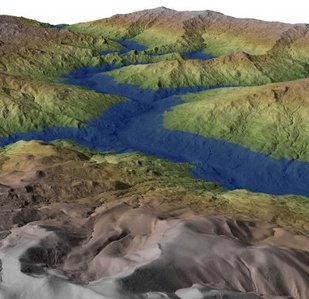
LIDAR: Light Detection and Ranging is the most revolutionary mapping technology in a century.  The accuracy and resolution of LIDAR allows for three dimensional analysis of the landscape, from bedrock to the tops of the tallest trees.  But LIDAR is much more than a map.  For a short instructive video on the uses and potential of LIDAR, click the image at left.

The Bridger Canyon LIDAR Project aims to "fly" the roughly 70 sq. mile Bridger Canyon Zoning District in Gallatin County, Montana to produce the highest quality three dimensional mapping currently available. 
The data collected will be used to create imagery and conduct analyses that can be used for:

Sustainable Growth and Planning
Wildlife Corridor Analysis
Climate Change Impacts
Avalanche Forecasting
Watershed Protection
Floodplain Mapping

For a short, entertaining video on the basics of LIDAR, click the LIDAR image above.  For more detailed information on LIDAR go HERE.


We are about 1/8th of the way along towards our funding goal of $100,000 with an initial grant from Bridger to Bangtails Coalition.  We need $62,000 just to purchase the raw data, and about $38,000 to develop value-added products such as Flooplain maps, Fire hazard models, geologic risk assessments, etc.
To learn more about the Bridger Canyon LIDAR Project, donate or help raise funds contact Lance Craighead or Kent Madin.

Powered by Create your own unique website with customizable templates.